Bucket List Adventure Runs in Oregon
by Chase Parnell — March 23, 2021
There’s no doubt that you’ll always have a certain nostalgia and love for the state you were born and raised in, but I think some people have to live somewhere else for awhile to allow it to develop. At 23, I moved to South Carolina for a year, and while I did enjoy observing the differences and stark cultural contrast in some ways, I also felt like I’d probably never really fit in there, even after picking up a closet full of polo shirts and loafers. Then after another stint in Oregon, I moved to Montana at 27 and stayed there for five years. It was a better fit for sure, but I did still have longings for Oregon. I can’t really describe it; I just had this certain sadness when I contemplated living in another state for good. So when the doors opened to return to Oregon in 2017, it felt right. I still fully intend on leaving Oregon at some point in the future, hopefully for a multi-year international adventure or another foray to the Rockies, but I know now that I want to always call Oregon my forever home.
It’s with this sort of romanticism that I bring to you a list of bucket list Oregon adventure runs. This process of digging into our state’s vast regions and trail systems really showed me how much I’ve prioritized racing over destination adventure runs. I’m excited to balance the scales a bit and tick off some more of these truly special runs.
With summer just around the corner, I think this is the perfect time to start nailing down plans. At the very least, I hope this resource plants a few seeds of inspiration. Maybe choose one or two to tackle this year and commit! If you’re from Oregon, you may have already done many of these, but I’m sure nobody out there has done ALL of them! And if you’re not from Oregon, go ahead and come get your taste of the greatest state in the land.
Note: this list is going to evolve over time. If you are simply flabbergasted that I didn’t include a certain run or route, reach out to me or throw it in the comments below. I’m certain there are some classics out there that weren’t on my radar. There’s also probably some central Oregon bias in my list because that is the region I know the best. Lastly, the purpose of this list is really just to give you an idea of what’s out there. If one of the runs captures your imagination, you’ll have to consult other sources to plan and prepare all the details of the run.

Timberline Trail
Stats: 40 miles, 10,000 feet gain.
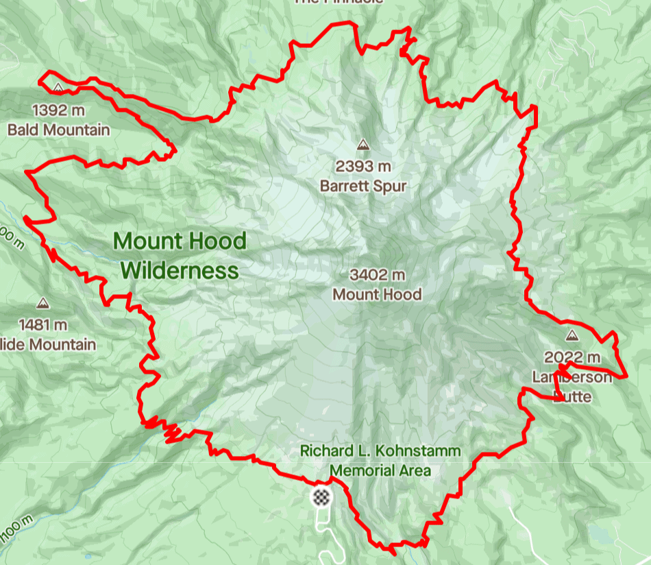
Description: The Timberline Trail circumnavigates Mount Hood, the tallest peak in Oregon. You get to see her from every angle, all the way around. It should cease to blow your mind that ultra runners can run around that behemoth in a day. But do know that this is a big day out! The FKT is 6 hours and 10 minutes but it seems most runners take 9-13 hours to get it done. The traditional starting point is from Timberline Lodge, running counterclockwise. It’s not uncommon for people to enjoy some bonus miles from missed turns or confusing junctions, so take your map and GPS, and be prepared for everything. Take your crack between August and early October for the best conditions. It’s hard to argue against this being the crown jewel run in Oregon.
Map:
Elevation Profile:

GPX file: Click here.
Route on Strava: Max King’s record setting day.
Fastest Known Time Route: Timberline Trail.
Three Sisters Loop
Stats: 47 miles, 7,000 feet gain.
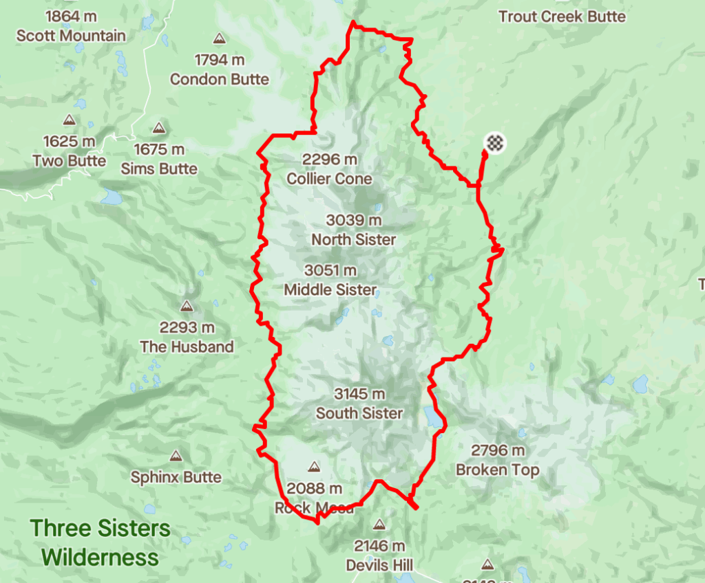
Description: This is essentially a big loop around central Oregon’s western skyline; a circumnavigation of the iconic Three Sisters: South, Middle, and North. You get some quality time on the Pacific Crest Trail on the western side and apart from the superhighway that is the hiking route up South Sister, you’ll have lots of long stretches of solitude. For efficiency, start at the Pole Creek trailhead on the northeast side of the route, just 20-30 minutes outside of Sisters, Oregon. It’s not the worst idea in the world to plant a car at Devil’s Lake should you need to bail. This is another big day out so plan appropriately!
Map:
Elevation Profile:

GPX file: Click here.
Route on Strava: Dylan Bowman’s 2020 “jog”.
Fastest Known Time route: Three Sisters Loop.
Three Fingered Jack Loop
Stats: 21.5 miles, 3,000 feet gain.
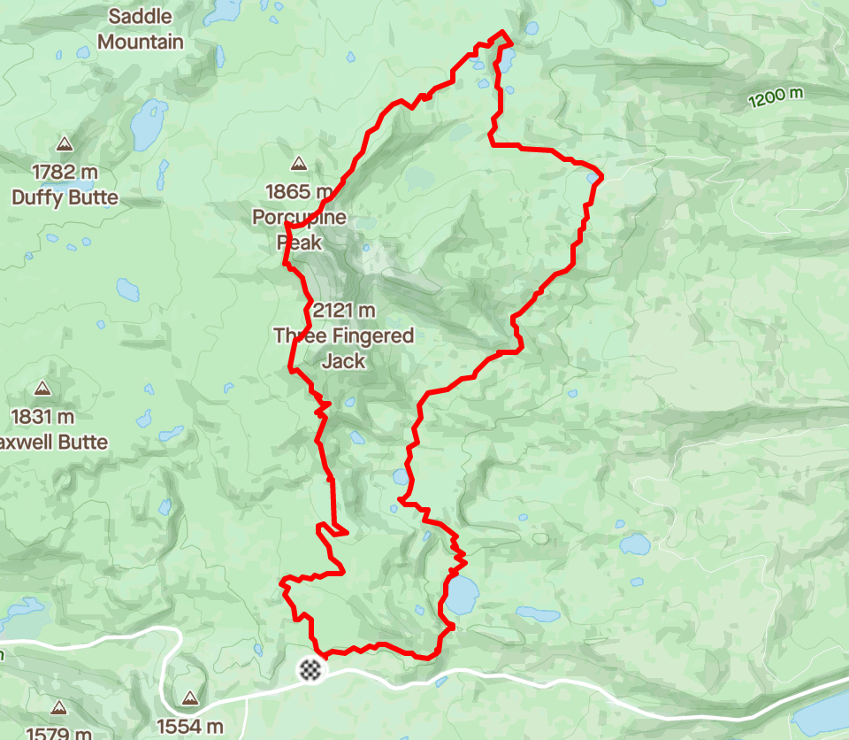
Description: This is the loop you do a few weeks before you go after Timberline Trail or the Three Sisters Loop. Great “warmup” to acclimatize to the feeling of being in a very remote area but instead of being 20 miles away from your car, you’ll just be 10. And if Three Fingered Jack isn’t the coolest mountain name out there then I don’t know what is. Spectacular loop, easily accessible, great views of the Cascades, and doable in one long morning as opposed to a full day. Hit it early and you’ll be back at the pub in Bend by noon for a well-earned pint.
Map:
Elevation Profile:

GPX file: Click here.
Route on Strava: Brittany Peterson’s FKT day.
Fastest Known Time route: Three Fingered Jack Loop.
Crater Lake Rim Trail
Stats: 32 miles, 3,700 feet gain.
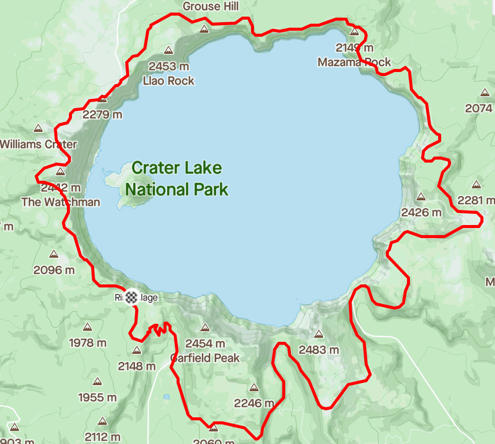
Description: Crater Lake is one of the most beautiful places on planet earth. It is magnificent. But for better or worse, the National Park Service (NPS) put a cement road around the rim of the entire crater, so beware, this is largely a road run. That said, there are lots of short trails to lookouts and little extenders if interested in taking your time and taking in all the views. For the vast majority of the summer and fall, I wouldn’t recommend competing with the cars and tipsy tourists. Thankfully, the NPS closes the busiest section of the road to vehicles twice during the summer for cyclists/runners/walkers to enjoy. So that’s your first option. Your second is to hit the loop after the NPS closes it to vehicles for the winter. This happens in late October or November 1st at the latest depending on the conditions. Simply monitor the NPS Crater Lake page for info and details.
Map:
Elevation Profile:

GPX file: Click here.
Route on Strava: Rachel Entrekin’s FKT.
Fastest Known Time route: Crater Lake Rim Drive.
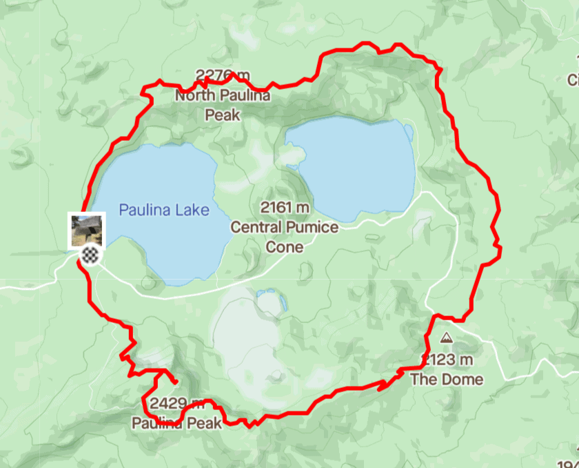
Crater Rim Trail | Paulina Peak & Newberry Crater
Stats: 20.7 miles, 3,100 elevation gain.
Description: About an hours drive southeast of Bend lies another interesting volcanic feature, the Newberry Crater and Paulina Peak. So what do we do? We tag the summit and run around the crater of course. You’ll pass through a variety of microclimates and enjoy spectacular views of the Cascades as well as incredible lava flows from eruptions occurring some 75,000 years ago. Some of the best camping in Central Oregon can be had down at the lakes in the crater, one of which even has a lodge and general store. Hit the run hard in the morning, burgers and brats for lunch, paddleboard and sunburn in the afternoon. Classic.
Map:
Elevation Profile:

GPX file: Click here.
Route on Strava: Justin Grunewald’s FKT that lasted a month before Max King came along.
Fastest Known Time route: Crater Rim Trail.
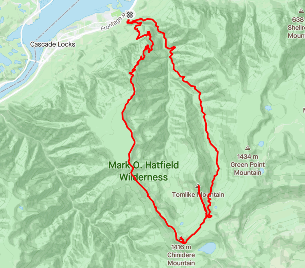
Chinidere Tomlike Loop in The Gorge
Stats: 25.5 miles, 6,800 feet gain.
Description: There’s no way you can leave the Gorge off the list! But correct me if I’m wrong, there doesn’t seem to be one preeminent loop or run that has earned the title as best run in the Gorge. With that said, shout out to Sean Haworth of Portland for putting this loop on my radar. You could do some crazy mega loops up there but if you’re looking for a burly marathon, this loop looks epic. Sean took this picture when he was up there so you can see why he recommended it out of everything there is do in the Gorge. If you’ve only got one day and you want a taste of all the Gorge has to offer, hit up the Chinidere Mountain Loop with Tomlike tag extender.
Map:
Elevation Profile:

GPX file: Click here.
Route on Strava: Sean Haworth’s day out with Donnie Vizzini.

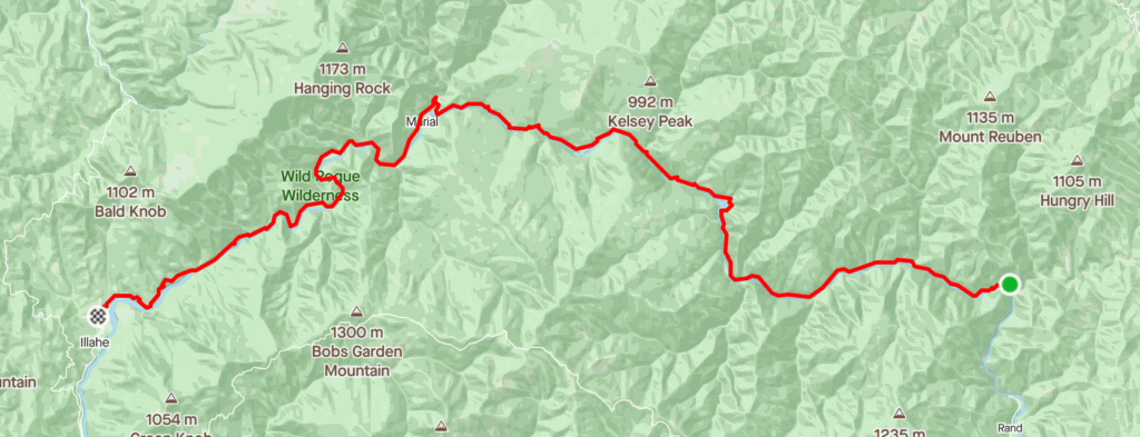
Rogue River Trail
Stats: 38.5 miles, 3,800 feet gain.
Description: Experience one of southwest Oregon’s most wild and remote trails. Follow the Rogue River downstream from Grave Creek to Big Bend as the waters slowly make their way from the Cascades to the Pacific Ocean. Technical and slow-going, but full of life and ancient beauty. Without this trail, the terrain is essentially impassible. The most western 16 miles passes through the Wild Rogue Wilderness but the entire length of the river along this stretch is designated as a National Wild and Scenic River. The Forest Service created an incredible 19-page PDF that tells the story, history, and landmarks you’ll see along this stretch of trail. This feels like one you’re going to want to take your time passing through to really soak it in. You’ll need two cars or you’ll pay a hefty price for a shuttle service.
Map:
Elevation Profile:

GPX file: Click here.
Route on Strava: Stephanie Howe’s FKT-setting day from 2015.
Fastest Known Time route: Rogue River Trail.
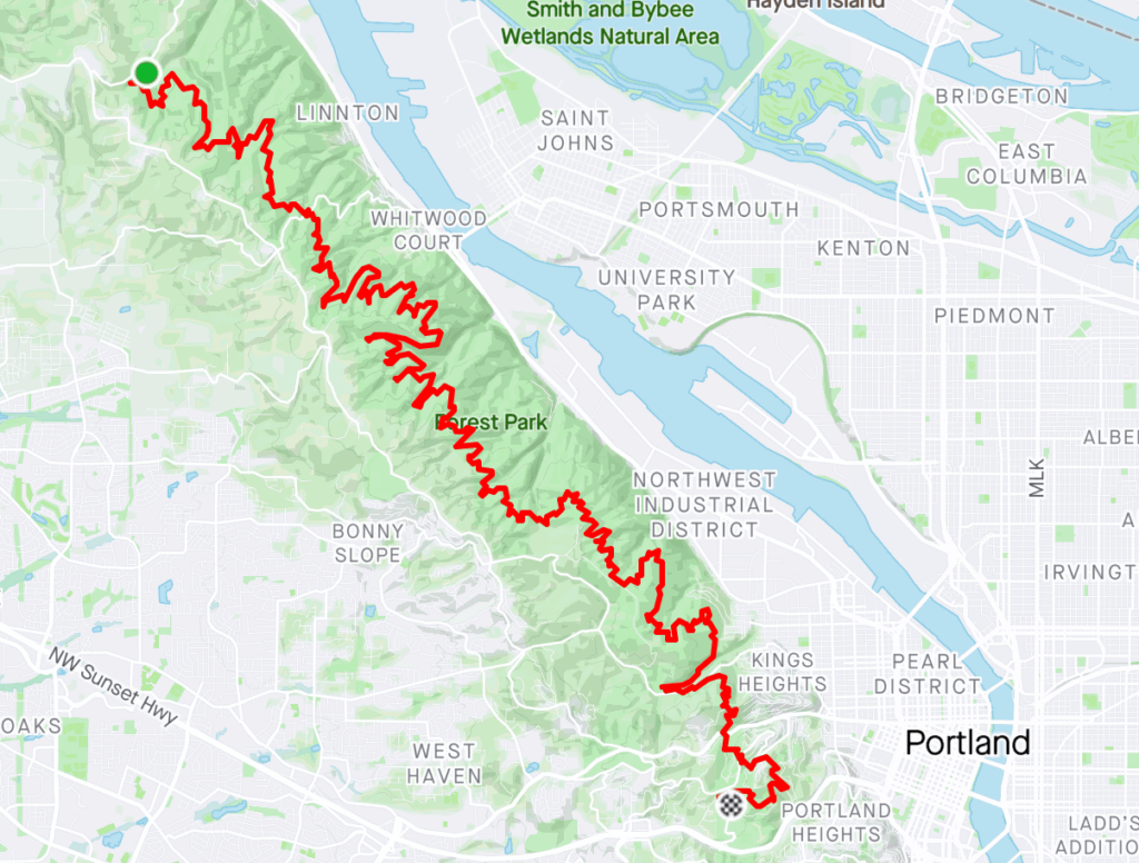
Wildwood Trail
Stats: 27 miles, 3,100 feet of gain.
Description: This point to point runs through Portland’s Forest Park in the hills west of town. Portland, as a fairly large metropolitan city, is lucky to have this escape so close and it’s really what makes Portland such a good running town. It’s the type of trail system that you could run everyday and you really wouldn’t have any business complaining. To be able to live within a couple minutes of all the arts, museums, concerts, sports, but also be able to sneak away into Forest Park, maybe even from your doorstep, that’s pretty awesome. The Wildwood Trail is classic Oregon valley running; dense woods, mud, ferns, moss, and streams trickling down every drainage. While there are a lot of circuitous trails and offshoots, the Wildwood Trail is well marked and easy to follow. And if you’re a big distance running fan in general, another element that makes it fun is that you never know who you might see out there on any given Saturday.
Map:
Elevation Profile:

GPX file: Click here.
Route on Strava: Marianne Falk’s FKT.
Fastest Known Time route: Wildwood Trail.
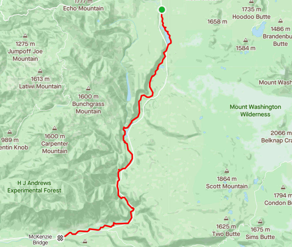
McKenzie River Trail
Stats: 25.5 miles, 900 feet gain.
Description: Starting at the north end of Clear Lake, you skirt the eastern shore and begin your parallel journey with the McKenzie River. You can run this trail in either direction but it’s obviously a little more pleasant running downstream. You pass Sahalie Falls and Blue Pool, two of the more impressive water features in the central Cascades. Certain sections of this trail are heavily trafficked during the summer weekends but hit it on a weekday and you’ll have one of the greatest runs of your life. I am admittedly a little biased, however, as this route is laced with nostalgia for me. In high school, my cross country coach would drive us over to this trail on Saturdays for a long run and breakfast at the Rustic Skillet, a country diner that unfortunately closed in recent years. We’d order cowboy omelettes and talk about goals, PRs, splits, workouts, and about how we were going to take Churchill High School to State! If you like a slight downhill grade and appreciate the comfort of having multiple bail-out points along the way, this is a great entry-level adventure run.
Map:
Elevation Profile:

GPX file: Click here.
Route on Strava: My run with Kimber Mattox and Forrest Towne.
Fastest Known Time route: McKenzie River Trail
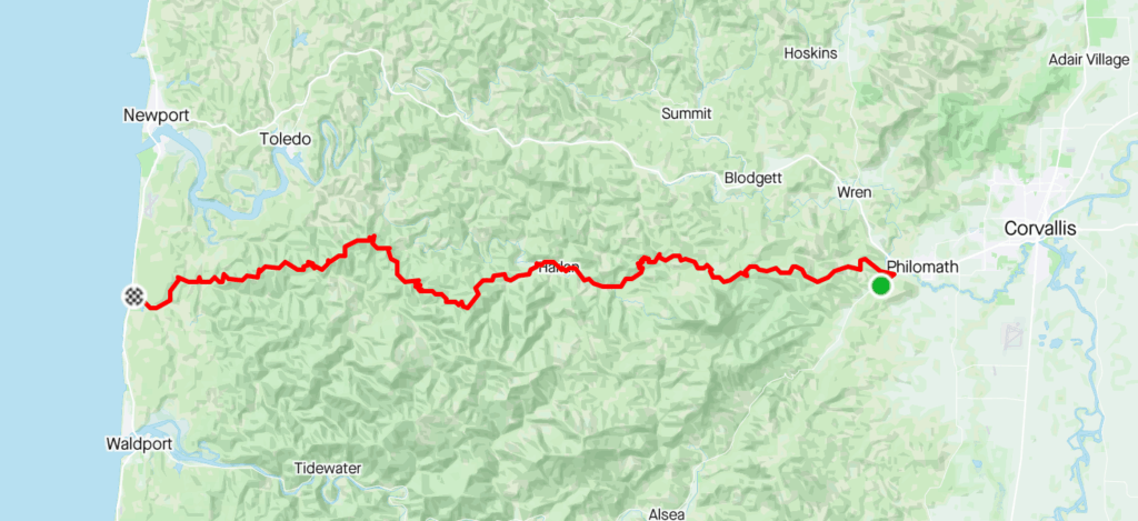
Corvallis to Sea Trail
Stats: 62 miles, 8,500 feet gain.
Description: This one really has to pique the interest of any ultrarunner in Oregon. Most Oregonians live in the Willamette Valley and make the winding meandering drive over the Coastal Range a handful of times a year. The idea that you could run to the coast from the valley is really a pretty special thing. It puts things in perspective and for me at least, it makes me realize again how incredible the human body truly is. What would take you an hour and change in your car can be done in a day on foot! Along this route you’ll pass the tallest peak in the coast range (Mary’s Peak), enjoy long stretches of uninterrupted singletrack, tread on just a couple miles of road, and finally pop out at Ona Beach, just north of Walport, Oregon. Read all about the trail here. When I do it, I’ll have a room booked at the Drift Inn in Yachats and have one of their wood-fired pizzas ready upon arrival.
Map:
Elevation Profile:

GPX file: Click here.
Route on Strava: Taylor Spike and Ashley Nordell from March, 2021.

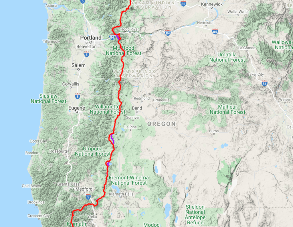
Pacific Crest Trail (Oregon Section)
Stats: Roughly 465 miles, 61,000 feet gain.
Description: This one is pretty self-explanatory: run the length of the Pacific Crest Trail that passes through Oregon. Most people who have attempted it start at the southern border and finish in Cascade Locks where the trail hits the Columbia River. You can try to blitz the route and finish in a week if you are a superstar or take the time to stop and smell the roses by giving yourself two weeks. That’s what I’d do. If you cover about 50k a day, you’ll be done in 15 days and have the adventure of a lifetime. What a way to develop some real intimacy with this state and the Oregon Cascades. Most of us will never have the three to five months to do the entire PCT but most of us could carve out a couple weeks if we were really motivated. Consider this the ultimate multi-day Oregon running adventure!
Map:
GPX file: Click here.
Fastest Known Time route: Pacific Crest Trail through OR.
Trip Report: Brian Donnelly’s FKT on the route.
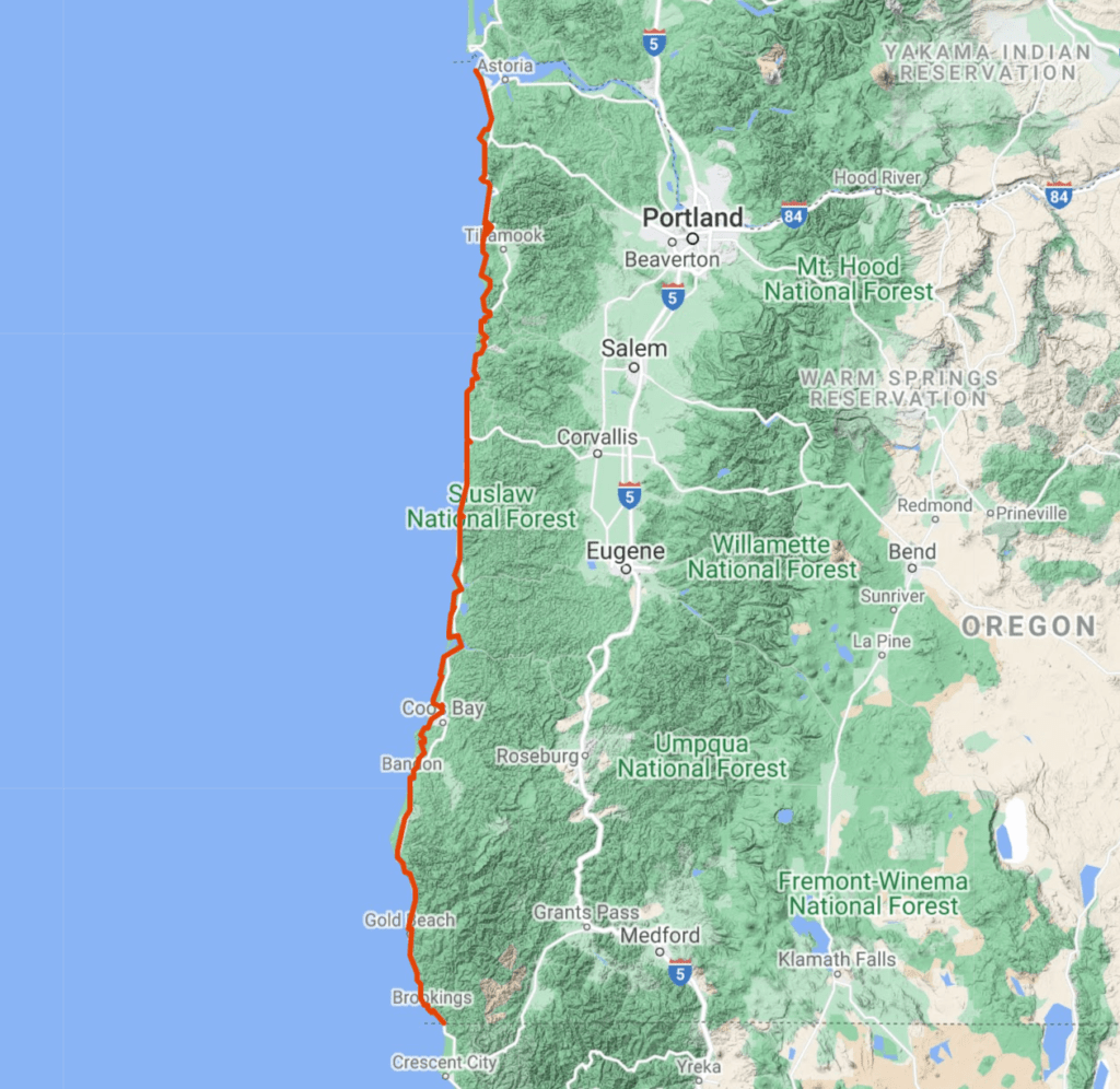
Oregon Coast Trail
Stats: 415 miles, 28,000 feet gain.
Description: They say there are mountain people and there are ocean people. If you are the latter, you might consider taking on the OCT. Contrary to the PCT, which is essentially entirely singletrack trail, this one is a little forced. Wikipedia tells us, “about 39 percent of the route is on the beach, 41 percent is on paved road, and 20 percent is on trail and dirt roads” but another source says only 10% is on road. There are complications such as seasonal beach closures, ferry schedules, and likely a few scary sections on the shoulder of highway 101. The Oregon State Parks great website about the trail describes it as, “Sandy beaches, meander through forest-shaded corridors, traverse majestic headlands and pass through 28 coastal towns.” If you’re someone who doesn’t love being deep in the backcountry and would prefer a bed to sleep and a shower each night, this long trail could be perfect for you. What an incredible achievement this would be.
Map:
GPX file: Click here.
Fastest Known Time route: Oregon Coast Trail.
Photo/Video tour: Josh Pulattie’s self-supported 12-day voyage. Stunning!
Oregon Desert Trail
Stats: 750 miles; all finishers are insane.
Description: I debated whether or not to include this one because it’s so unfathomable and absurd to consider “running” the ODT that it’s sort of a waste of your time to even consider. That said, there are a few nuts out there like Christof Teuscher who become obsessed with these types of objectives and can’t get them out of their heads until they are completed. If I made the Oregon Coast Trail sound like there were added logistics, I apologize, this is the long trail with logistics! One-third of the route is off-trail, water is sparse, you are exposed to the sun and elements essentially the entire time, and if something happens to you out there, you will likely be many hours removed from any sort of rescue or medical facilities. That said, they don’t call it God’s country for nothing. The Oregon desert’s harsh beauty and wild solitude is unlike anything else; huge wide open vistas, geologic gems, sagebrush, juniper, and tall grass as far as the eye can see. Any time I run out east of Bend, I’m in awe of the natural beauty of the high desert and drawn in to this wonderful counterbalance to the woodlands and high country of the Cascades.
Map:
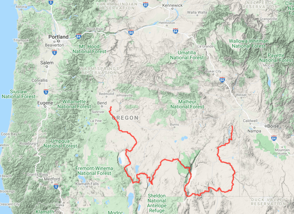
Elevation Profile:

GPS Data, Maps, and Descriptions: Oregon Natural Desert Association’s ODT Resources.
Trip Report: Christof Teuscher’s 13-episode vlog style report.
Bonus Trip Report: Concise write-up by Katie Gerber.

The Wallowas
Description: The running in northeastern Oregon is GOOD. If you are a mountain runner by nature, there’s no better place in the state. The tallest peaks are in the Cascades but to put it in perspective, there are 14 peaks over 9,000 feet in the Cascades that run north to south across our entire state. In the Wallowas alone, there are 48 mountains over 9,000 feet, all clustered within a mountain range that is no more than 40 miles end to end. The linkups are endless. There’s a reason they are called the Swiss Alps of Oregon. That said, these mountains are remote! From Portland, we’re talking a five and a half hour drive; from Bend, even longer. I created this explorer runs category for destinations that don’t seem to have a single iconic route but that you absolutely must check out some day. If you like a little scrambling, the Sacajawea–Matterhorn traverse is mind-blowing (shown below). I also included a loop I did way back in 2013 (unfortunately my GPS died but we finished up a 35 mile horseshoe that finished at Wallowa Lake). All that to say, take a week to go explore the Wallowas and cherish your time there.
Map:
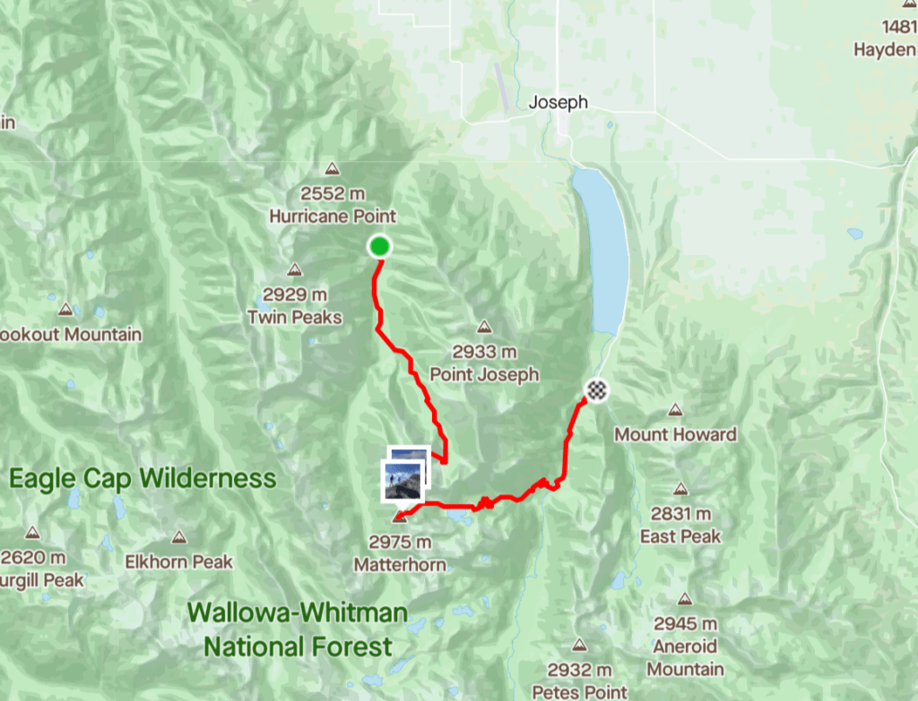
GPX file: Hurricane Creek to Wallowa Lake horseshoe with Sac/Matterhorn tags.
Route on Strava: One of the most memorable runs of my life. Shoulder season with snow.
Bonus Route on Strava: 35+ mile mega horseshoe (unfinished after battery died). All trail.
Fastest Known Time route: Christof Teuscher’s Eagle’s 33. You won’t believe this.
Steens Mountains
Description: Another super remote but beautiful area in southeastern Oregon. To get a real flavor, check out the Steens Mountain running camp website for lots of good photos of what Steens has to offer. I am a two time camper alum; probably my most memorable experiences from high school. Send your kids there if you can! Again, lots of good trails and routes to explore. If you have someone who will shuttle you, Heather Laptalo, Kristina Kurcinka, Becky Schreiber ran what they called the Steens Mountain Traverse. The clutch piece of this route is that you end at the Alvord Hot Springs, which I imagine would be quite a pleasant finish to your day. Make sure you’re prepared if you choose to go over this traverse; they said there is a fair amount of route finding and bushwhacking once you drop off the eastern flank of the mountains.
Map:
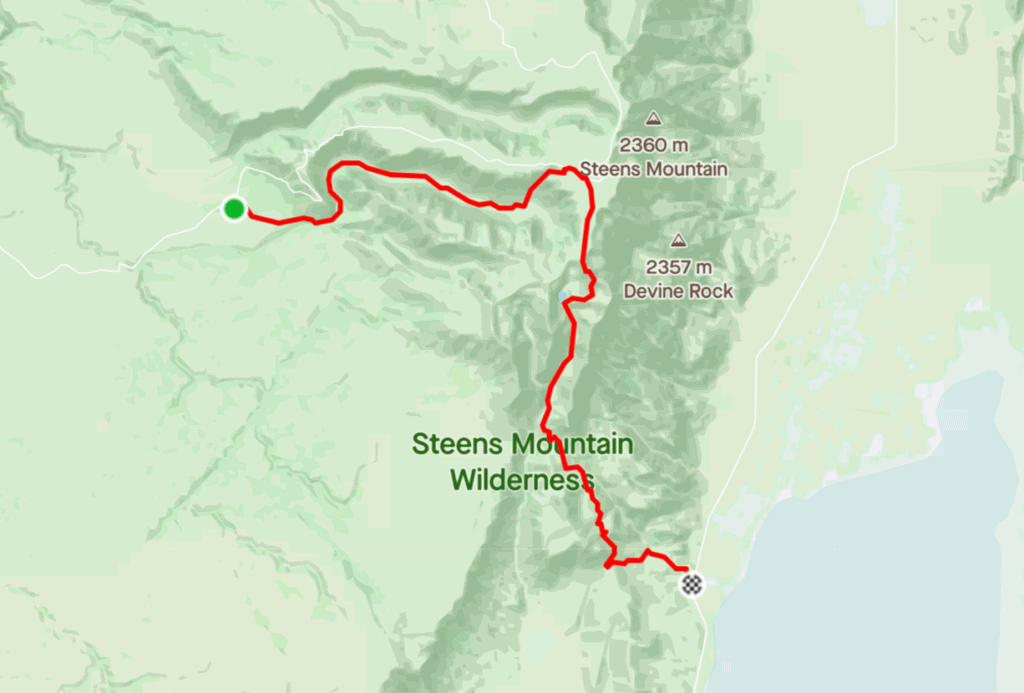
Elevation Profile:

GPX file: Click here.
Route on Strava: Aria Zoner’s Crossing.
Fastest Known Time route: Steens Mountain Crossing.
Owyhee Canyonlands
Description: Located in the far southeastern corner of the state, you’ll find the Owyhee Canyonlands, the largest roadless and unprotected area in the lower 48. Similar to the Oregon Desert Trail, any running and exploring in the region should be done only with lots of preparation and planning as access to water and medical services are minimal. In 2016, Jeff Browning and Jesse Hayes set off on an adventure run with the goal of running the last 170 miles of the Oregon Desert Trail that passed through the Owyhee. Check out Jeff’s written recap as well as the associated Patagonia film. I’ve included the Strava data (below) from their 65 mile day that took them 24 hours to complete. For us mortals, maybe fastpack this over 72 hours? If you’ve got a car with some ground clearance, there are plenty of beautiful spots to access for short hikes and runs as well. You could spend a lifetime exploring this area and never see it all.
Map:
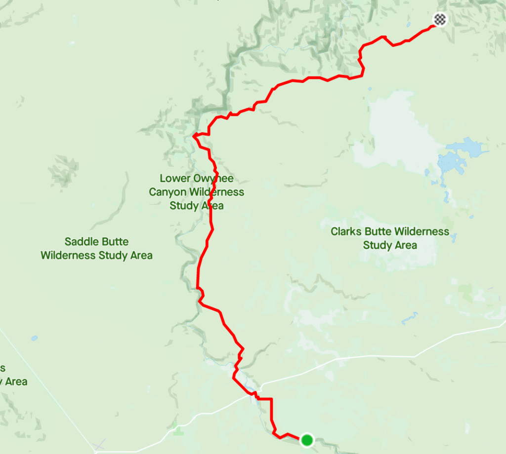
GPX file: Click here.
Route on Strava: Owyhee Canyonlands (Day 3 of 4).
Instagram account to follow and begin learning about the area: Wild Owyhee.
Alright, what do you think? Any glaring omissions I need to add? Sort of hard to pare things down into categories and include a diverse set of options without creating an encyclopedic catalog.
What I love about Oregon is that it really does have it all; from west to east we have the coast, the coastal mountain range, the fertile valley, the cascades, and the high desert. There really is something for everyone. I hope this resource spurs you on to get out there and explore. In completing any of these runs, you’ll add a layer of nuance and context to your understanding of Oregon’s great landscape, history, and environment. The better we understand, the more likely we are to serve and protect what we love. Tread lightly out there but enjoy to the fullest!
If you found this article useful, consider sharing it with a friend or supporting Treeline Journal by becoming a patron for as little as $2 a month! And don’t forget to sign up for our free weekly Rise & Grind newsletter, a single email every Thursday morning with all the latest ultra news, race reports, motivation, and inspiration. Thank you!

Might be worth making a note that the three sisters loop will require permits for day use if you wanted to start at Devils lake, or potentially even just take a break / get crew aid in the parking lot there? I’m still a bit confused on what defines “trailhead entry points” on the NFS website, but Devils lake trailhead definitely falls under the new permit system – https://www.fs.usda.gov/detail/willamette/passes-permits/recreation/?cid=fseprd688355
That’s a great point! I’m bummed about this hurdle but also relieved. It was getting pretty out of control out there. Especially heading up South Sister. Insane! BTW: I saw you at Sisters Coffee Company the other day. Biking!
Yeah agreed that the permits should make everything safer as well. It was getting sketchy for bikes with all the cars parking on the side of cascade lakes highway when the trailhead lots filled up. The ride from Bend to Sisters coffee is one of my favorites. I’ve been scouting out a bunch of town -> trailhead rides for some potential human powered FKT stuff. Can’t let Colorado have all the glory for those bike to summit routes.